- Thumbnail
- Resource ID
- 8a21e553-9d22-11e9-8d7d-000d3ab6a624
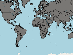
- Title
- World countries (ESRI, 2014)
- Date
- July 2, 2019, 6:38 p.m., Publication
- Abstract
- This dataset is the World Countries 2014 database from ESRI (data from DeLorme, 2014), slightly adapted to be consistent with the Maritime Boundaries v10 dataset (Flanders Marine Institute, 2018). Changes to the original World Countries database include adding ISO 3 digit country codes and making these consistent with the EEZs and adding the Western Sahara and Hala'ib Triangle.
The original World Countries database is redistributable with proper metadata and source/copyright attribution (esri.com).
The Maritime Boundaries dataset is available under a CC BY-NC-SA license at http://marineregions.org
- Edition
- --
- Owner
- gridanode
- Point of Contact
- devrsgis@gmail.com
- Purpose
- --
- Maintenance Frequency
- None
- Type
- not filled
- Restrictions
- None
- None
- License
- None
- Language
- eng
- Temporal Extent
- Start
- --
- End
- --
- Supplemental Information
- No information provided
- Data Quality
- --
- Extent
-
- long min: -181.8000030518
- long max: 181.8000030518
- lat min: -90.8683242798
- lat max: 84.5338211060
- Spatial Reference System Identifier
- EPSG:900913
- Keywords
- no keywords
- Category
- None